Skyhawk Analytics
Let us show you how our cutting edge aerial informatics platform can help your organization run in a smarter and more efficient way!

Let us show you how our cutting edge aerial informatics platform can help your organization run in a smarter and more efficient way!
We collect aerial imagery and video data from drones, satellites and aircrafts along with IoT data from ground based sensors.
Transformation and Intelligent Aggregation of datasets using Skyhawk’s scalable cloud infrastructure. Our proprietary deep learning and AI algorithms intelligently detect and predict any hidden patterns or trends.
Timely delivery of intelligent reports and actionable insights to augment and support data-driven decision making for businesses and organizations.
Skyhawk Analytics provides farmers and agronomists with a detailed augmented view into their fields using aerial and sensor data to help manage risk, reduce production costs, and maximize yields.


We can provide emergency professionals with near real-time overview and insight into disaster areas, helping to reduce both the loss of both life and property.
Skyhawk’s analytics engine can examine critical infrastructure such as roads, railways and energy assets to support preventative maintenance programs and reduce the risk of equipment loss or failure.

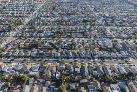
We provide real estate professionals with a birdseye view of entire neighborhoods down to individual properties combined with key market demographics to enhance marketing and sales efforts.
Skyhawk Analytics can provide help to a multiple other domains.
Just contact us below to see how we can help you!
At Skyhawk Analytics, our passion is to gain a better understanding of the world around us through data. We created the Skyhawk Aerial Informatics platform specifically for users and consumers of ever growing image and video data generated by airborne vehicles such as drones, airplanes, and satellites.
Our platform’s proprietary analytics engine processes this data and analyzes it using intelligent learning algorithms that allow us detect and see interesting patterns, objects, and trends. Performing this analysis in near real-time and at scale is what makes the Skyhawk Aerial Informatics platform unique in the market and provides value to our customers.


